Railway Heritage Footprints in the West Donlands – Part 5 of 6
 Click on each image for a closer look!
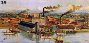
West of Cherry Street was, of course, the Gooderham & Worts Distillery, a firm first established in the 1830’s, now a National Historic Site. In 2003, the area was reborn as the popular Distillery District retail, dining and tourist area with what is considered the finest collection of Victorian industrial architecture in North America. G&W was one of those Toronto industrial concerns that benefited considerably from its ability to ship products all over North America by rail. By the 1890’s, when the lithograph seen in IMAGE #25 was published, G&W was the largest industry in Toronto and the most prodigious distillery in Canada, producing one-third of the nation’s total output. The Gooderhams also financed the narrow-gauge Toronto & Nipissing Railway and the Toronto, Grey & Bruce Railway. The extent of railway activity is readily apparent in the lithograph when the mainline railway corridor passed right through the property. The current Union Station Rail Corridor now traverses the space occupied by the two large structures in the foreground. The large grey structure left of centre in the lithograph is the stone distillery opened in 1861 and now the oldest building on the property.
The e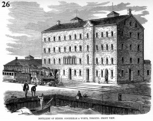 ngraving shown in IMAGE #26 depicts an eastbound Grand Trunk passenger train passing in front of the stone distillery in 1863, only seven years after the railway had opened their line between Montreal and Toronto, linking Canada’s two largest cities and reducing the travel time from days to hours. The 4-4-0 or “American” type locomotive seen in the engraving was the most predominant form of railway motive power until the turn of the 20th century.
The final stop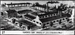 on our tour of railway heritage in the West Donlands and environs is the Toronto Car Wheel Co. (IMAGE #27) located in the early 1870’s on the northwest corner of Front and Cherry streets. In that era, railway car wheels were much less robust than they are today and they had to be frequently replaced. A large inventory of finished wheels can be made out standing in the yard on the left side of this tiny engraving that was taken from an 1876 bird’s eye map of Toronto.
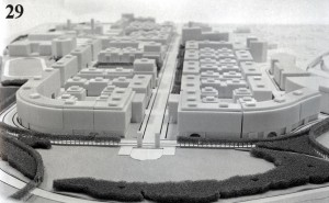
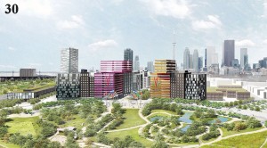
In 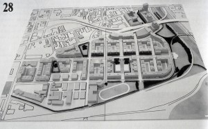 1988, the city and provincial governments announced a massive redevelopment project in the area that was intended to alleviate the affordable rental housing shortage by building a mixed-use community for 14,000 residents. The project was initially known as St. Lawrence Square, appropriately named after the small park at the top of Cherry Street that disappeared about a century ago. However, to avoid confusion with the St. Lawrence neighbourhood that had already been developed west of Parliament Street, a citizen’s group was formed to choose a new name. With the winds of political correctness sweeping through the land, the group came up with the virtually unpronounceable name of Ataratiri, after a Huron village located 130 kilometres outside the city. IMAGE #28 shows a conceptual model of the 80-acre site while IMAGE #29 is looking west along Front Street. Immediately apparent is the then-prevailing dislike of high-rise buildings, preferring instead long rows of identical Lego-block mid-rise buildings. With flood control and environmental remediation to cost over $200 million even before construction began, the Ataratiri project collapsed with the 1992 recession and the land remained mostly empty for the next 15 years. IMAGE #30 shows a similar perspective looking west along Front Street at the development project which is currently underway in that area. It certainly is an improvement over the Ataratiri project that resembled a Soviet-era public housing project.
Click here to read the last in this series of postings.
Click here to return to the first posting in this series.
Posting by Derek Boles, TRHA Historian

