Historic interpretive plaques now installed in Roundhouse Park!
 Click on each image for a closer look!
.
A project at the Toronto Railway Heritage Centre that has been ongoing for the past several months was completed in the middle of November, the installation of the historic interpretive plaques throughout Roundhouse Park. The plaques were researched and written by TRHC Historian Derek Boles and were designed, manufactured and installed by Fontasy Signs & Display, a company based in Goodwood, Ontario, just beyond the end of the GO Transit Stouffville line. Representing the City of Toronto in this endeavour were Gordon Lok and Jo Ann Pynn.
.
The plaques are critical to the interpretation of our National Historic Site. Many people walk through Roundhouse Park at all hours of the day and night, completely unaware of the historical context and how the park has evolved over the years. To put things in perspective, there are 8,760 hours in 2010 and the Toronto Railway Heritage Centre was open for 196 of them over 48 days. The onus is on the TRHA to interpret the site in as many ways as possible, especially when our volunteers aren’t there to provide the interpretation. The plaques are also intended to guide people through the park in a logical sequence so that they can appreciate the heritage highlights along the way.
.
The changes at the site over the past 25 years are truly astonishing. If you were to take someone who worked at the roundhouse the year that it closed in 1986 and somehow magically transport them into the present, they would have an extremely difficult time recognizing the environment. Other than the roundhouse, the turntable and the water tower, nothing remains of what was once there. Even the most familiar structure on the horizon, the coaling tower, was moved 600 feet west of its original location.
.
There are a total of 13 plaques and I will take you on a guided tour, illustrating each one and explaining some of the challenges. Please note that when I photographed the plaques, there was a protective film over them that has since been removed. They now look a lot sharper than they do in the photographs.
.
One of the first problems we became aware of was that the anchors for the plaque columns needed to be mounted on the grassy lawn, not on the concrete asphalt and paving stone surfaces that cover much of the park. A further constraint was that visitors had to stand on the hard surfaces while reading each plaque rather than on the grass. This means that some of the plaques are actually turned away from what they interpret. We figured that anyone who would take the time to read the signs would also have the wherewithal to orient themselves correctly. Another challenge was that just below the surface of the park is a web of electrical and information conduits and water pipes which had to be carefully located before the anchors could be installed.
.
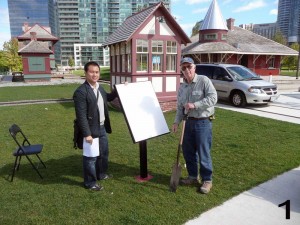
So, here is the sequence of plaques starting from the big sign out on Bremner Boulevard near #6213, but first a shot of two people involved with the plaques installation.
1. The City of Toronto’s Gordon Lok and Fontasy Signs proprietor Richard Knobbs are seen on October 1, 2010 making preparations to install the signs.
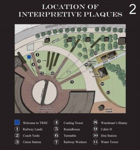
2. This map at the entrance identifies the location of each plaque and the path a visitor must follow to see them all.
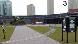
3. The entrance sign and first four plaques are arrayed along the wide paving stone walkway leading from Bremner Boulevard to the turntable.
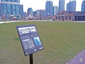
4. Plaque #1 describes the extent of the railway lands through downtown Toronto, a concept that will be very difficult to grasp once the condo/office tower development east of Lower Simcoe Street is completed.
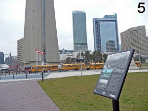
5. Plaque #2 describes the coach yards. Almost 80% of the real estate at John Street was devoted to the servicing and storage of passenger cars, including Jackman and Cape Race, two artifacts in the TRHC collection.
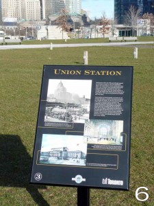
6. Plaque #3 deals with the relationship between the John Street facilities and Union Station, the reason the roundhouse was built in the first place. Unfortunately the view of Union Station seen here over the top of the plaque will be obliterated once the Delta Toronto Hotel/Bremner Tower is completed at the northeast corner of Lower Simcoe Street.
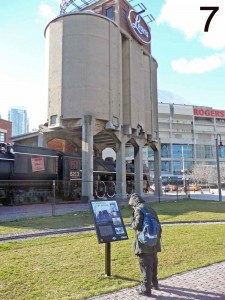
7. Plaque #4 explains the coaling tower, a structure that completely baffles most visitors to the park. The plaque also points out and encourages people to walk around the tower in order to appreciate David Oram’s stunning mural of steam locomotives under the tower while it was in its original location.
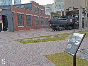
8. Plaque #5 interprets the roundhouse itself. We would have preferred to mount this just left of centre in this view but clearance for the mini-rail did not permit this.
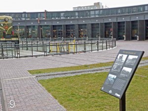
9. Plaque #6 interprets the turntable. Again the placement is somewhat awkward but there was no way to install this on the paving stones.
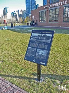
10. Plaque #7 is devoted to the workers of John Street, the thousands of employees who worked at the facility from 1929 to 1986.
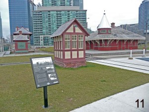
11. Fortunately Plaque #8 was able to be placed in an optimal location.
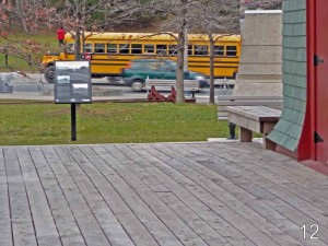
12. Another awkward placement for Plaque #9 interpreting Cabin D.
13. Plaque #10 and Don Station.
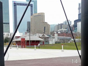
14. The most awkward placement was for #11, the water tower plaque, seen here from underneath the actual structure. An instruction in the text tells readers to look behind them
.
Posting and pictures by Derek Boles
.
