Aerial Images: Google Updates Its View of Roundhouse Park!
Click on each picture for a closer look!
.
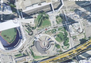
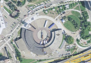
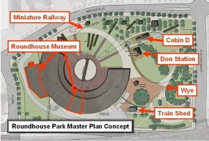
In an earlier posting called Roundhouse Park from Above! – Part 1 of 2: Googling It! we introduced you to the Google Maps’ satellite view of the Roundhouse Park. Google Map has recently updated their aerial view of the Roundhouse Park area. The images above are the latest views. Note in the close up view at the right, that the Master Park Plan appears almost entirely implemented (see the Park Plan below). The only obviously visible missing part is the green grass to the north of the turntable. This image was likely captured earlier in the fall of 2009.
.
In this image, note that we can spot #6213 beside the coaling tower, our CLC Whitcomb and the CP Switcher #7020 on the turntable and the Roundhouse Park buildings in their current locations. The miniature railway right of way is also clearly evident as well as the foundations and walls of the miniature railway depot.
.
Posting by Russ Milland; Image by Russ Milland and Google Maps
.


